How using high-quality drones can save time and enhance accuracy in your surveys.
Unmanned Aerial Systems (UAS) have revolutionized the surveying industry, providing a faster, more efficient way to gather accurate data. By utilizing advanced drones and technology, you can streamline your survey processes and achieve precise results. In this post, we’ll explore the efficiency of UAS surveys and how partnering with a skilled operator can benefit your projects.
How do UAS surveys save time compared to traditional methods?
UAS surveys can cover large areas quickly and efficiently, reducing the need for extensive manpower and equipment. This leads to faster data collection and analysis.
What technology do you use for UAS surveys?
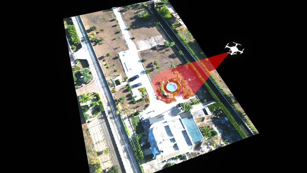
I use advanced drones like the Autel Evo Max 4T, equipped with high-resolution sensors and real-time remote viewing capabilities for precise and efficient data collection.
Are UAS surveys accurate?
Yes, UAS surveys provide high accuracy due to advanced sensors and real-time data processing. The use of Ground Control Points (GCPs) and RTK modules further enhances accuracy.
Can I monitor the survey process in real-time?
Yes, with real-time remote viewing capabilities, you can monitor the survey process and make necessary adjustments on the fly.
Why should I choose a Part 107 certified operator?
A Part 107 certified operator ensures that UAS surveys are conducted safely and in compliance with all FAA regulations. My certification and expertise guarantee reliable and professional service.
Efficiency is crucial in any surveying project. Traditional methods often require significant time and resources, leading to delays and increased costs. UAS surveys, however, offer a more streamlined approach. High-quality drones equipped with advanced sensors can cover large areas quickly, capturing detailed data with minimal effort. This not only saves time but also reduces the need for extensive manpower and equipment.
At Rainbow Creations, I use state-of-the-art drones and technology to conduct efficient UAS surveys. My equipment includes the Autel Evo Max 4T, which provides high-resolution imagery and precise data collection. With real-time remote viewing capabilities, you can monitor the survey process and make adjustments as needed, ensuring that the data collected meets your specific requirements.
Working with an experienced Part 107 certified operator ensures that your UAS surveys are conducted safely and in compliance with all regulations. My expertise in aerial mapping, surveying, and data analysis allows me to deliver accurate and reliable results, helping you make informed decisions for your projects.
Ready to streamline your survey process and save time? Contact me today to learn more about my efficient UAS survey services and how I can help you achieve your project goals.
Beyond the Horizon


Email Us
Prefer to write? Drop us an email with your queries or project details. We'll get back to you promptly.
Get Social
Stay updated with our latest projects and news. Follow us on social media.